Places, Earth
Driving Through the "Flyover States," 2022
Driving Through the "Flyover States," 2022
|
|
Places, Earth
Driving Through the "Flyover States," 2022 |
|
|
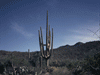
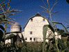
This trip began as an idea to drive my wife to Springfield, Missouri to visit her parents. I planed it for after finishing an eight month project. By the time for the trip, my wife was busy with her job and didn't want to take time off and her Mother was sick, possibly with Covid, then her Father got a cold. My wife canceled but by this time I had found so many interesting things to do along the way, I modified the trip a little and went alone. I usually prefer driving my trusty 21-year-old station wagon, but I wasn't sure I trusted her with a 4,500 mile trip, so I went with Isabel, my six-year-old Mustang. This was Isabel's first trip outside of California. As I squeezed everything into the car, I decided it was just as well that my wife was staying home because she would have had to sit on the roof. There had been so many last minute changes, I was still planning the day before I left, I decided to do more research on the road. Day One, Asphalt and Petrified Wood I headed east on I-210 and then north on I-15. I lost the radio reception and switched to an audiobook. I would spend the next eleven days with J. R. R. Tolkien. I couldn't help but notice a large truck on its side on the other side of the highway in Victorville. At Barstow I switched to I-40 east and noticed a sign, two thousand something miles to Wilmington, North Carolina. I wasn't going quite that far, but eastward I went. Interstate 40 roughly parallels old Route 66 about half way and there were several signs to connect to existing sections of the old "Mother Road" as it was called. There are museums to Route 66 in Victorville, Barstow, and possibly other towns. About 30 miles east of Barstow I stopped at a rest area with no name and poorly maintained. I walked a little, took a few photos, used the restroom, and continued east. Two hundred miles of barren Mojave Desert slowly passed behind. About midway is an exit to Amboy to the south and Kelso to the north. I stopped for gas in Needles and continued east. At Noon I crossed the Colorado River for the second time in a year and entered Arizona. I noticed three long trucks, each with a wind generator vein. I pounded east on I-40. The clouds ahead were pretty, the landscape was green. It was surprising how quickly the landscape changed after I crossed the river. Near Kingman, traffic came to a stop for some time because of an accident. I took a short nap. We started moving slowly and a lightning bolt flashed ahead. A few drops of rain hit the windshield and still we crawled along. Finally we reached the site of the accident, a semi off the road, smashed guard rail, and only one lane open. As I started to move, it rained just a little. Eventually I reached Flagstaff and found the Visitor Center at the Flagstaff Depot. This is an active Amtrak depot and while I was getting information, a long freight train rumbled by. I stretched my legs, got some info, and took a few photos. I pushed on. I realized that I was not going to reach the Petrified Forest Visitor Center before it closed. The highway parallels the railroad and I saw many BNSF trains carrying cargo east and west. I reached the south entrance to Petrified Forest National Park, off of Highway US-180, a little after 5:00. The Visitor Centers close at 5:00, the gates close at 6:00, and they want everyone in their cars heading out by 7:00. The south Visitor Center had just closed when I passed by. There is one park road running north-south with a few side roads. This is the only park including part of the Painted Desert area which extends hundreds of miles west. I stopped a few times to photograph the terrain and then at Crystal Forest. Crystal Forest is a modest loop trail surrounded by large and small pieces of petrified trees with some views of Painted Desert. I walked the trail taking lots of photographs as the shadows grew longer. While these are mineral replacement fossils of trees and no original wood remains, you can still see tree rings and bark. I stopped a few minutes at Agate Bridge which is a petrified tree trunk lying across a small stream bed. Today there is a concrete beam keeping it from falling, but it must have surprised early visitors to see it. I looked at the map and the time and realized I was about one third through and it was almost 7:00. I hurried north. I exited at the north entrance which had me confused for a few minutes. As I approached Interstate 40, I expected an on-ramp, but the park road crossed over I-40 and continues a few more miles before looping back and accessing the Interstate. There are two Visitor Centers, Painted Desert Visitor Center is at the north end, but closed now. There were three automatic gates allowing people to exit but not enter. At first I thought I was locked in as two of the gates required your car to almost touch it to activate. I've wanted to visit this park as long as I can remember, but only saw a small fraction, maybe I can return someday. Anyway, it was about 25 miles back to Holbrook where I had a reservation, so I traveled west on I-40 in the dark. I got gas and found the motel. I checked into my motel and mentioned the time adjustment since Arizona doesn't observe Daylight Savings Time, so during Standard Time, Arizona is on Mountain Standard and an hour ahead of California, but when California is in Pacific Daylight, Arizona is still on Mountain Standard and the same as California. Then the twist I learned from the motel desk clerk, is the Navajo Nation observes Daylight Savings Time so it is still an hour ahead of California and same as New Mexico, so I should reset my watch at the border of the Navajo Nation. The room was nicer than I needed and I settled in for the night. Day Two, Where Are the Missions? I got up, got ready, and went to continental breakfast. They didn't have a waffle maker, but they did have an automatic pancake maker, first time for that. I packed, loaded, and checked out. I photographed a water tower and a few buildings in Holbrook and a half block before the church, I noticed Navajo County Historical Society in the old Courthouse, a beautiful old building like those no longer built. I only had fifteen minutes to explore the two floors of exhibits. I must try to return (8-5, daily). The church was a nice building and the people friendly, but not that many people. I don't know how small towns survive in a world of mega this and conglomerations that. Back on I-40, J. R. R. Tolkien and I continued east. Within a few minutes I was back in the National Park, but only because the highway and BNSF railroad run through with no access. I'm sure the truck of large onions I passed was the same as yesterday. I entered the Navajo Nation and adjusted my time pieces, watch, car clock, and time in the camera. Onward to the Land of Enchantment, New Mexico. I somehow missed the official border, but it was clear that the geology changed. Around Gallop to the north of the highway, red sandstone cliffs, some softly rounded, rose. The highway crossed the Continental Divide at 7,263 feet. The landscape glided by. It's time I mention the many small signs calling this the Purple Heart Trail. I since noted the same sign on I-5 in California. I took Exit 149 and followed direction to Islata looking for Mission San Agustin de Islana. I finished The Hobbits. After half an hour I gave up trying to find the church and used Map on my phone to get pointed back toward Albuquerque. A few miles east I got gas at a station off the old Route 66. I cruised east. I loaded the next audiobook disk, The Fellowship of the Ring. A few miles west of Santa Rosa I stopped to get my blood circulating and organize the car at a rest area. East of Santa Rosa I realized the green had given way to tan. I rolled on. A little further I made a last stop at another rest area. Back on the road I pushed on trying to reach Amarillo before dark. I entered Texas and Central Time so I resent the time on everything again. Within a few miles there is a large wind farm to the left that continued for several miles, eventually switching to the other side. It got dark as I headed east. When I exited at exit 60 and followed the frontage road, I almost missed Cadillac Ranch a famous large artwork. It was dark and the exhibit is about 500 feet off the road, it was only when I saw cars parked seemingly for no reason that I realized I had found it. I grabbed my tripod and camera and trudged though the mud. I circled in the mud taking long exposure photos of the row of cars stuck nose down in the ground. The cars are so covered with graffiti, one hood looked to have ten inches of paint on it. The surrounding field was planted with sprouts of something I didn't recognize. It was quite dark by the time I wrapped up. I stood at my truck about ten minutes changing boots and bagging my muddy boots and tripod. Because of road work, I drove along the frontage road a long distance before I could reenter I-40. A few minutes later I found my hotel in Amarillo, checked in, cleaned mud off the boots and tripod, ate, and finally got to sleep two time zones ahead of this morning. Day 3 - Oklahoma, OK I had gotten to bed late the night before but still awoke about 5:30. Since continental breakfast didn't start until 7:00, I was able to get ready slowly, although I would have preferred an earlier start. The news covered flooding to the south, but here in Amarillo it was just a light rain. As I loaded the car, I noticed railroad ties used in landscaping, only these were the first concrete ties I've seen used this way. I got back on Interstate 40 continuing east. Within minutes I was beyond the city and in the flat Panhandle of northern Texas. I crossed into Carson County with more wind generators to my right, then on the left. I crossed into Gray County and noticed a leaning water tower. I-40 wove in and out of Donley and Gray Counties with wind farms on both sides. I passed the largest, nicest rest area I had seen in three states. Fifteen minutes later I regretted not stopping. I rolled on. I got gas in Shamrock. I thought to myself that it was convenient that most of the states I traveled through don't have vapor recovery nozzles since my car doesn't like them. I care about the environment, but some stations with vapor recovery nozzles take 20 minutes to trickle the gas into the filler tube of my Mustang. At home I know which stations work better. I entered Oklahoma a little after 10:00. I glided east. I passed a pickup pulling a trailer with an antique military truck that I know I passed a day or two before. A hothead harassed me and I was surprised there wasn't a California plate on the truck. More wind farms passed by. At Oklahoma City I said goodbye to Interstate 40, at least for now. It didn't take long to find Oklahoma City National Memorial Museum commemorating the bombing of 1995. The tour through the museum begins in a reproduction of a water department hearing room in an adjacent building where a recording exists of the moment of the explosion. The doors open into two floors of exhibits and artifacts including parts of the rental truck and a section of the museum building that was damaged in the explosion and left as an exhibit. Outside, in the grass area, which was the footprint of the destroyed building, there are seven rows of chairs, a different number of chairs in each row. Most of the chairs are clustered at the east end. The number of chairs in each row represent the number of people killed on each floor and it was the east end that suffered most of the damage. There is a column of five chairs apart from the rest, these are for people killed in other buildings. A large reflecting pool covers that area that was once the street. Between the pool and museum building are landscaped areas that once supported two other building damaged in the explosion and later demolished. Eventually I found my next stop, the Oklahoma State Capitol. It was summer break and the Capitol was mostly empty and there was plenty of parking. I began with the front, including a symbolic oil rig. Oil was a major boom to the Oklahoma economy. I went to the Visitor area and spent the next hour or so with Ralph on a one person tour of the interior. Ralph told me of the history of the Capitol building which was built from 1914-1917 but because of World War I, the current dome was added in 2002. Inside the lobby is a statue, about seven feet tall titled The Guardian. It is a copy of the statue atop the doom which is twenty-two feet tall. I was shown the state seal on the floor of the rotunda with the slogan, "Labor Omniavincit." Oklahoma was the 48th state joining the Union in 1907. The tour covered the Representative's chambers for the 101 representatives and the Senate Chambers which is smaller because there are only 48 senators. After the tour, I wandered the interior a few more minutes. Next I took fifteen minutes to walk around the exterior, and returned to the car. The Governor's Mansion was only a block or two away, but it took me fifteen minutes to find the parking. It wasn't easy to get a photograph, but as I drove away I noticed there were better views on the north side, but I wasn't going around the block again. I couldn't come this far without stopping at Pop's 66 Soda Ranch on old Route 66. It is a super convenience store. While it sells gas in front, the focus is the beautiful building which has hundreds of exotic soda bottles on floor to ceiling shelves inside the windows. Unfortunately the giant soda bottle in front wasn't lit during the day. There is a soda counter and gift shop. Pops is at 660 U.S. Route. 66, Arcadia, Oklahoma 73007. I was running late, but stopped a short time in Tulsa to visit an old friend who retired there. My hotel was in Bentonville which should have taken about two hours. I mistakenly followed the Map Ap on my phone. Not only did I get off a good highway at a small road #59, it was in Oklahoma and the Ap wanted me to get off at #59 in Arkansas. I drove a country back road in the dark for half an hour and finally reached #59 in Arkansas, got gas, then continued driving east another half hour before veering north. Later I learned that I could have stayed on Highway 412 to Highway 49 that would have easily brought me to my hotel a half hour earlier. I settled in for a good two and a half hour sleep. Day Four, Capital Day After a too short sleep, I got ready to find a very thin continental breakfast. I got off a little after 7:00 headed south to rejoin Interstate I-40 east. I stopped at a nice rest area with a large green lawn. I usually bring a battery booster on long trips in case I have battery problems but fortunately I haven't had a need to use it until today. I help another driver with very dirty battery cable clamps. I arrived at the Arkansas State Capitol about 11:00. It was during the legislative summer recess so, like Oklahoma the day before, the Capitol was quiet and it wasn't too hard to find parking. Here the tour was self guided but I wandered the five levels and enjoyed the visit, assisted by several helpful staff members. I was told Secretary of State is the largest department because that department handles so many subjects from supervising elections to facility maintenance. The House chambers were twice the side of the Senate chambers since there are twice as many House member as Senate. Following, I walked around the capitol to see the various monuments. It rained off and on during my visit. I followed my Mapquest directions to the Governor's Mansion, but it must have been the wrong address or the back gate. I can't believe the governor drives this street and doesn't have it repaired. The William J. Clinton Library has revitalized the downtown area of Little Rock and I had difficulty finding the Library because of all the construction and closed road. After a few detours, I was parked at the Library. The complex of the Clinton Library includes a former station of the Rock Island Railroad and the tracks once passed in front of the future Library and across the river in a lift bridge, built in 1899. Today the area around the Library is a park and the lift bridge (in the up Position) is a pedestrian bridge across the Arkansas River. I toured the Library filled with exhibits on President William Jefferson Clinton. One unusual aspect of this Library is that visitor can actually view shelves upon shelves of bound archival papers from the Clinton Administration. They are locked but can be viewed upon legitimate reason. Also more accessible are bound volumes of President Clinton's schedules. On the upper level is a beautiful large Christmas Tree topper by glass artist Dale Chihuly. Once I finished at the museum, I walked across the bridge and back, viewing the river and a few barges. As I slowly worked my way back to the car, it rained off and on. I survived. I headed for Central High School, am important site in the history of racial unity. Unfortunately the Visitor Center closed at 4:00 and it was 4:10. I could see the school, but there were still many students in front and I didn't want to interfere. I pressed on to my hotel, found a grocery store, got gas, and settled in for a good night, a little earlier than yesterday. Day Five, A Little Cave Art I arose about 5:30, got ready, and was off by 8:30. Back on I-40, I headed west, back the way I came yesterday. I noted three wind generator blades on trucks heading east. A quick stop at Big Piney rest area just east of London. I continued drifting west on I-40 and turned north at Interstate 49, through Bobby Harper Tunnel, retracing my path from yesterday, I observed the many trees and the textures and colors, they don't look like the trees of California. I exited at Bentonville and it was obvious that there was much construction everywhere. Just at the last turn to my destination I noticed Amazeum, maybe next time. A few minutes later and I had arrived at my primary destination for today Crystal Bridges American Art Museum. A prize exhibit is the Bachman-Wilson House designed by Frank Lloyd Wright. This was only the second Frank Lloyd Wright house (other being Hollyhock House) that I have seen. While Wright is famous for his design proportions and relationships, the low ceilings and narrow hallways made me uncomfortable. I then strolled the grounds and next the galleries. Several spaces, including the restaurant, are literally bridges with ponds below. I wandered three hours, but since the museum has begun an expansion, I may need to return in about five years. I re-entered the highway and headed north. I crossed into Missouri and notices two things. The road cuts exposed the same limestone I saw five years ago along I-44 further east and never anywhere else. For the first time since the California / Arizona border, the speed limit was 70 and not 75. It's still faster than by covered wagon. Twice the speed limit was 80 on toll roads in Oklahoma and Kansas. I arrived at my motel, Route 66 Rail Haven. I want to say two things about this modest motel. It is not five star. It is a quaint, historic Route 66 motel. It sits beside the old Route 66. Outside are two antique cars, antique gas pumps, and a red phone box. Inside the lobby is an old payphone and other nods to Route 66. The rooms have photographs and artwork celebrating the history of the motel and Route 66. Elvis stayed here twice and now I have stayed here twice and if I come to Springfield again, I hope to stay here again. If you want five star, stay somewhere else, if you want to stay in a historic Route 66 motel, you will enjoy your stay. I had been wanting to see Fantastic Caverns since my visit to Springfield five years ago. I had to hurry to catch the last tour for the day. This cave is unique, it is the only cave in the United States that is a drive through. You don't drive your own car, but ride in trailers pulled by a jeep. It turned out I was the only passenger and sat in the passenger seat of the jeep. The cave was discovered in 1862 when John Knox's dog Juno chased an animal into a small hole. In time, a hole was blasted large enough for a car and the cave was used as a speakeasy during prohibition. The jeep slowly crawled through the cave past stalagmites and stalagmites and other formations. Below the river still runs through it. The jeep entered in a newer opening and we exited through the speakeasy opening. I had one last stop for today, actually a reconnaissance for tomorrow. Bass Pro Shops Outdoor World was about to close, but I wanted a preview for tomorrow, so I observed the lobby, asked a few questions, and said goodnight. I found a grocery store for dinner and wrapped up for the night. Day Six - A Lot of Walking (You Call This an Outdoors Store?) I got up, got ready and went to breakfast. My first stop was Bass Pro Shops Outdoor World. It is the flagship store, first and largest store in this chain, filled with lots of merchandise, but also museums, a large aquarium, live animals, and complex displays. It may sound strange to say I spent all day here, but I did. I stayed an hour and a half going through the store and bought some cast iron cookware. This trip began as an attempt to take my wife to visit her parents and brother, and although she stayed home, I had a short visit with them and returned to Bass Pro Shop. As I left for this visit, I noticed the complex also includes a taxidermy shop, rod and reel repair, and pick-up. When I returned, I parked off of Sunshine where there is a dedicated parking and entrance to the Wonders of Wildlife National Museum and Aquarium (500 West Sunshine Street; Springfield, Missouri). I noticed a lodge, part of the Bass chain, across the street. There are three sections to the Wonders of Wildlife: The aquarium wound and climbed seemingly endlessly, a gallery of award winning wildlife photographs, and a wildlife exhibit that also wound on at length. I was quite tired by the time I reached my car but I'm glad I saw it. I returned the Route 66 Rail Haven and got ready to check out tomorrow. Day Seven, Walt and Harry The day started well, for a hour. I wanted a few photos of this historic motel on the way to breakfast, but the camera had malfunctioned again. Then I dropped my breakfast on the way back to the room, I guess I'm on a diet. An hour and a half behind schedule, I was ten miles north on Highway US 65. The Fellowship of the Ring gave way to The Tower Towers as I slowly traveled north along the quiet highway passing through small towns and past farmlands. I exited onto Highway 24 east and encountered several construction delays before turning north onto MO-5. About 15 minutes later I was in Marceline, Missouri, a town where Walt Disney once lived and drew inspiration for Main Street at Disneyland and many animated animal characters. Walt said this where he was happiest. While waiting at a railroad crossing, I quickly photographed an old railroad station. Train past, I proceeded across the track and realized the building was the Walt Disney Boyhood Museum, my destination. I wandered the museum about an hour looking at all the memorabilia and watching some of the videos. The two things that attracted me most was an Autopia car from Disneyland and a collection of Disneyland models built by Dale Varner as a hobby from drawings given to him by Walt. I then walked and drove around town photographing things significant to the Disney story, and some I just liked. On the way out of town I drove to the site of the home and a recreation of the Disney Barn that once stood in his Holmby Hills home near Los Angeles. The original barn is now in Griffith Park and I saw that a few years earlier. I realized this was the turn around point. From here on, I was going home. I entered US 36 west. I was trying to reach the Harry S. Truman Presidential Library before 5:00. Had I been sure I wouldn't make it, I would have stopped at General John J. Pershing Boyhood Home State Historic Park, but there wasn't time for both. I continued west. I switched to I-35 and thundered south trying to reach the Library in time. I arrived at Harry S. Truman Presidential Library at 4:20 and hurried inside, I had a little over a half hour. I hated rushing through, but I had no choice as I tried to absorb each space. I made sure I saved 15 minutes for the eternal flame, grave site, and Truman's Office. I was taking my last photograph in the courtyard when the guard started locking up. I got gas and struggled to find I-70 west. I crossed into Kansas and continued west. Because of construction, I-70 ended at 6th Street in Topeka and I had a bit more driving to my hotel. I got a sub sandwich for dinner and settled in. Day Eight, Beginning Week Two - Another Capitol and I Like Ike I got ready, checked out, and drove to the State Capitol. I was early so I walked around the exterior photographing details, statues, and monuments. There was a farmers' market at the south end of the parking lot but I decided to spend the hour before the opening of the Visitor Center looking for the Governor's Residence. Once again Mapquest sent me to the other side of town. Eventually I found he Governor's Residence, not far from my hotel. It was easy to see two exterior facades from a distance from outside the gate. There are tours one day a month, but of course, this wasn't the day. It looked nice as far as I could see. This was the best view I had of the three governor's mansions I saw on this trip. I arrived back at the Visitor Center at the Capitol, and this time found the correct parking garage, minutes after the Visitor Center opened. First I joined the history tour that took us from the basement, which serves as museum, to the forth floor. Kansas became a state in 1861 and the Capitol was built from 1886 to 1903. The structure was built in three phases. The east wing was built first and divided into two spaces, for House and Senate. After the west wing was finished, the House moved in and the first space was remodeled for the Senate. Later the center, Rotunda, and dome were added. There is a noticeable difference in floor height of a few inches as passing from House to center to Senate because of the phased construction. Next I joined the Dome tour which starts on the fifth floor. Up a long flight of stairs wrapping around the inside of the outer cylinder and outside the inner dome. A platform ran around allowing us to see the back of the inner dome. Another flight to another platform and my damaged lungs complained. I caught my breath as the tour continued up the flight of stairs to a landing and then to the center, maybe thirty feet above the inner dome. The tour continued up the winding stairs to the cupola while I waited below. I struggled to the base of the winding stairs but could go no farther. I was still sitting on the last landing and the base of the winding stairs catching my breath and contemplating if I could make it up the last 100 winding steps, with to place to rest, when the tour started back down. There were words of sympathy and praise for getting three-quarters of the way with my lung damage, but also telling of the view and the cool breeze, inside the outer dome was quite warm. It was easier going down and I took a few more photographs on the way down. Back on I-70, I cruised west. In Abilene I exited.. A few minutes later I was at Eisenhower Presidential Library. There are five buildings, Visitor Center/ Gift Shop, Museum, Library, Boyhood Home, Place of Meditation (final resting place). There were a few scattered sculptures. I did my best to photograph the house which was under restoration. I strolled the Museum, the Library is only open to researchers, and I visited the final resting place. It started to rain. Back on I-70 west, shortly before exiting at Highway KS-156, I observed wind turbines slowly rotated in the rain. The geographic center of the Continental United States (the 48 states not counting Alaska and Hawaii) is about 50 miles north near Lebanon, Kansas, but no time today. The rain subsided as I exited onto KS-156, then returned. I drove on through intermittent rain toward Dodge City. Ahead was lightning, close by at Great Bend, but about ten minutes later the storm had passed. At Lernid, I stayed on Highway 156 instead of switching to Highway 56 and drove 12 miles west before I realized. While getting back on course, using 183, it started hailing, visibility was at most one hundred feet, my hood at least, but ended before I could find a safe place to pull over. Finally on Highway 56/50, I found myself surround by wind turbines. I got gas at Spearville and noticed a sign for a "scenic overlook" which turned out to be the Spearville Wind Farm. I took more photos of wind turbines. I photographed a grain silo in Wright. After many hours on a slow highway with lightning and hail, I reach Dodge City. I included Dodge City in my loop to see the city. I checked in, did the tiniest bit of sight seeing, settled in, and got some sleep. Day 9 - Do You Know the Way to Santa Fe? I arose, got ready, ate, and checked out. I attended Mass and got out of Dodge. I stopped a few minutes at the overlook for the Gray County Wind Farm surrounded by wind turbines and fields. Wind turbines spread out in all directions quietly rotating. I rolled southwest along U. S. 56. I've often heard of the flat lands of Kansas, but there were rolling hills until I approached Dodge City. Now I looked out over a flat landscape in all directions. I stopped a minute to photograph a grain silo in Sublette. I plunged southwest on U. S. 56. I got gas in Hugoton and continued. Every five or twenty miles I passed through a small town marked, even at a distance, by a tall collection of grain silos. I continued southwest toward Oklahoma. I noticed a sign for Cimarron National Grasslands. A few last photographs in Kansas and into the panhandle of Oklahoma. The road felt different. More texture, darker, and less shoulder. Not as well maintained. Grasslands on both sides. I slowed for a dust devil crossing the road ahead. I had been carefully observing the speed limit all day, as I had been for the previous eight days, and as I drove slowly through Boise City watching for my turn from the round-about back onto Highway 56, a law enforcement car followed me and continued until three or five miles outside of town when the driver gave up and turned around. I wasn't speeding. I stopped a few minutes to photograph the "Welcome to New Mexico" sign and to regroup. A minute later a smaller "Welcome to New Mexico" sign. I guess they want visitors to feel welcome. I drove on. The landscape seemed about the same, the road a little rougher. I continued. Southwest and west on a lonely road for the next two hours. After driving Highways 156 and 56 since this time yesterday, I finally entered Interstate 25. Just in time, a rest area a little north of Las Vegas, New Mexico. Minutes later I noticed a sign for Fort Union National Monument and quickly existed. I was too late to do anything in Santa Fe anyway, so this was my one stop for today. An eight mile long highway wound its way to the west. A few turnouts allowed views of wagon wheel ruts from the Santa Fe Trail. After about ten minutes I arrived at Fort Union, once the largest military outpost between California and the Mississippi River. I had only thirty minutes for the one mile path between the ruins. Access to the first site is restricted. The second site is melted since it was made of mud. The third site is large but not in much better condition. I didn't have time for the Infirmary a hundred feet off. It was quite large a settlement once and the melting walls help to understand the scope of the fort. Not long once back on I-25 I passed through Las Vegas, New Mexico. Yes, there is more than one Las Vegas. I pressed on to Santa Fe. I eventually I reached Santa Fe and found my lodgings. As I left to get dinner, I noticed the wind came up as it got dark. I settled in. Day Ten - Another Capitol Idea I arose, got ready, did some last minute research, and left. The Capitol was close, but more road work slowed the trip. The Capitol, many historic sites and buildings, museums, shops, galleries, and eating establishments are within walking distance. I got information, including a useful little map, at the Visitor Center. I started with the Capitol, one of the few without a dome. They call it the round house and it is, in fact, a large disk. I took a tour that explained the abundance of beautiful art, took us to the Senate Chamber, and ended in the Governor's outer office. I wandered a while on my own. Next on to San Miguel Mission, which was closed. A few photos and on to the oldest house in the United States. A few steps to Loretto Chapel with the Mysterious Stair. The story of the stair is the sisters prayed for someone to build a stair to the choir loft because no one could do it. A man named Joseph arrived and said he could do it if left undisturbed for three months. After three months the sisters came to see the progress and the impossible stair was complete, Joseph was gone, no one in town sold him lumber, and the wood was not local. It was easy enough to find The Cathedral Basilica of St. Francis of Assisi which is closed on Mondays, this was Monday. I photographed the exterior and a few statuary. I wanted to see Palace of Governors which was closed for renovation. A small section was open through the New Mexico History Museum which I would have liked to have visited, but there just wasn't time. I thought maybe if I still had time, but it would have take two or three hours. I walked past New Mexico Museum of Art and lots of shops and galleries. I did visit the Georgia O'Keeffe Museum which I enjoyed. I found interesting the cases of bones, horns, and rocks that she used as inspiration. A few blocks south I found The Shrine of Our Lady of Guadalupe. I am told this is not a Mission, but is the oldest shrine dedicated to the Lady of Guadalupe. By now I was tired so I trudged back to the car, now several blocks away. On the way back to the car I photographed the Bataan Memorial Building. More soldiers died in the Bataan Death March from New Mexico than any other state. I heard thunder in the distance as I walked back to the car. I photographed the other side of the capitol and a side annex and a better shot of the east side. Someone had said the San Miguel Mission was now open so I returned to San Miguel which was now open. There is confusion if it is a real Mission. Some people argue there were no real Missions in New Mexico, other say there were. Anyway, I saw the church whatever it might be. It is considered the oldest existing church in the United States. It started raining as I walked back to the car. Back on I-25, I rolled south. I ran into a dust devil that surrounded the car with debris and tumble weeds, but I survived (see video). I switched to I-40 which would take me most of the way home. I got gas in Albuquerque and continued west. The Two Towers yielded to The Return of the King. I continued west on I-40. Two rest areas in a row were closed so I ate my salad leftover from yesterday on the side of a small side road. I pressed on into Arizona. I crossed into Arizona and as I approached the north entry to Petrified Forest Nation Park, I considered stopping. It was about 5:30, the entry gates close at 6:00 but the Visitor Center closes at 5:00. Since I was too late for either Visitor Center ten days earlier, I decided to skip it hoping I can return some time when I can arrive earlier. I checked into the motel and got the same nice room I had ten days earlier. I was tired so for dinner, I made do with food in the cooler and snack bag that hadn't been consumed already. I downloaded my photos to learn my camera had another malfunction. It is suppose to save photos as jpg and raw, but the last dozen photos were only tif. I couldn't change it back and finished the trip saving only as jpg. I got a good night's sleep for tomorrow. Day Eleven - Long Journey Home I awoke about 5:00 before the alarm and got ready. I checked out and entered I-40 west and rumbled home. I stopped a few minutes at Meteor Crater Rest Area and a few minutes later I passed the road to Meteor Crater which I had seen 13 years earliewr. As I approached high altitude Flagstaff, the desert gave way to conifer trees. A little after Williams the trees were gone again. At Seligman I stopped for gas and a sub sandwich for lunch. I noticed the auto-focus of my average had failed. As I got back in the car, a busload of passengers started filing into the convenience store that I had just left. The road stretched on. I stopped at a rest area a half hour east of the Colorado River. A little after Noon I crossed into California, reduced my speed to 70 MPH, and stopped at the agricultural inspection station. When I was younger, the inspectors where looking for most fruit, today they were only checking for citrus. With the exception of California and Missouri, all the other states I traveled through had a speed limit of 75 MPH. I stopped at John Wilkie Safety Rest Area at Fenner and I was told it is scheduled for a major rebuilding in 2024 or 2025. I continued west past Kelbaker Road which connects Amboy to Baker through Kelso . One last rest area about twenty miles east of Dagget, the last rest area before home. It is in more need of replacing than the previous. At Barstow I switched to I-15 south. Through Cajon Pass and west on 210. Eventually I arrived home. I was only half was through The Return of the King so that would wait till the next trip. My family was glad to have me home, especially the dogs. My cat missed me so much she was all over me instead of her usual angry that I was gone. The next morning two cats threw up hair balls and I knew I was home. The following day I spent an hour cleaning bugs of the front of the car. Three days later I left on the next adventure, Alone Again, Naturally (see Gilbert O'Sullivan). total: 4,341 miles |

|

|

|
| Note:This is not the official site for any of the places shown in Places Earth. Places Earth is not responsible for accuracy of the information. Hours of operations, prices, exhibits, and sometimes locations are subject to change without notice. |
|
Support this Web Site I hope that you find this web site helpful. It started because of my love for Architecture and interest in History and a desire to share my photographs and tales of my adventures. I don't allow paid advertising. This web site is for your benefit and enjoyment and I make no profit on it. For twenty years it has been supported primarily from my regular paycheck as a Set Designer. If you are in the need of a designer, please see my Set Designer portfolio site Set Design Portfolio. |
|
Links |

|
This site maintained by Kenneth A. Larson. Copyright © 2004 - 2023, Kenneth A. Larson. All Rights Reserved. Website content including photographic and graphic images may not be redistributed for use on another website. |

|

|

|